Managing flood risk
The implementation of the EU Floods Directive saw the publication of draft flood maps late last year. Flood risk management plans are due to be completed by the end of 2015.
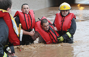
As the impact of climate change becomes more apparent, flooding is becoming more frequent and severe in Ireland. Historically, flood risk was addressed through structural or engineering flood protection measures in response to flood events. The EU Directive on the assessment and management of flood risks, (known as the Floods Directive), which came into force in late 2007, is now the main driver behind flood management and prescribes a more proactive approach to flood risk management with an increased use of non-structural and flood impact mitigation measures.
The Floods Directive required a preliminary flood risk assessment which identified areas of existing and foreseeable future potentially significant flood risk, which are referred to as ‘Areas for Further Assessment’ (AFAs). Flood hazard and risk maps for the AFAs were then developed. Flood risk management plans have to be prepared by the end of this year, setting objectives for managing the flood risk within the AFAs and identifying a prioritised set of measures for achieving these objectives.
The Directive requires the preliminary flood risk assessment, flood maps and flood risk management plans be prepared with neighbouring jurisdictions in cross border basins. The draft flood risk maps were published late last year. The Flood Directive recognises that there are a number of rivers that cross or form the border in Ireland and cooperation between authorities on both sides of the border is necessary for the effective management of flood risks from these rivers. The implementation of the directive requires rivers and coastlines to be assigned into International River Basin Districts (IRBDs) and there are three IRBDs in Ireland:
• The Shannon IRBD;
• The North West IBRD;
• The Neagh-Bann IRBD.
In addition to the international river basin districts there are a number of national River Basin Districts (RBD). There is one RBD in Northern Ireland, the North Eastern RBD and four south of the border:
• Western RBD;
• Eastern RBD;
• South Eastern RBD; and
• South Western RBD.
The work under the directive is being carried out under a national programme managed by The Office of Public Works (OPW). This involves a programme of river Catchment-based Flood Risk Assessment and Management (CFRAM) Studies in line with the Floods Directive. Details of the programme can be found at www.cfram.ie. The national programme is being undertaken by six engineering consultancies and is focused on 300 AFAs which were selected following the Preliminary Flood Risk Assessment.
The projects under the CFRAM programme are examining in detail the causes of significant flooding throughout each River Basin District and will produce integrated plans of specific flood risk factors. The projects will also examine options to reduce flood risk, including measures both structural and non-structural.
Structural measures include constructing flood defences or increasing conveyance capacity. Non-structural options includes management of water levels and the introduction of flood warning systems.
The flood risk management plans will have to be completed by the end of this year and will take into account economic, social, environmental and technical factors.