Transport strategy for greater Dublin

eolas magazine outlines some of the key elements of the plan to invest over €10 billion for the development of transport infrastructure across the greater Dublin areas for the next two decades.
The 2011 Draft Transport Strategy outlined many of the key transport infrastructure investments that needed to be undertaken to ensure Ireland could meet growing demand. It was, however, prepared against the backdrop of Ireland’s financial crash and in a time of economic slowdown. The Transport Strategy for the Greater Dublin Area 2016-2035 has been published in the context of rising numbers of population, growing employment and subsequent predictions of increased demand for travel.
As well as outlining the transport infrastructure and services for the Greater Dublin Area, the strategy is also key to providing a transport planning policy and shaping the investment priorities for other agencies involved in land use planning, environmental protection, and delivery of other infrastructure such as housing, water and power.
eolas looks specifically at the proposals within the strategy by mode of transport.
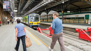
Rail infrastructure
Heavy rail infrastructure plans, many of which were also mooted in the preceding 2011 plan, aim to create a full metropolitan area DART network linking and connecting all existing lines. The three major construction projects consist of reopening the Phoenix Park Tunnel Link for passenger services (completed), linking the Kildare/Cork line to the city centre, providing additional train paths through the city centre by completing the city centre Re-signalling Programme and implementing the DART Expansion Programme – “which will provide DART services as far north as Drogheda; to Hazelhatch on the Kildare Line (including a tunnel connection from the Kildare Line to link with the Northern/ South-Eastern Line); to Maynooth in the west and to the M3 Parkway”.
As well as the major construction projects, the strategy outlines improvement in services, ranging from the creation of a new train control centre, through to a programme for station upgrades and new station builds and improving the current fleet stock and condition.
In terms of light rail infrastructure, most of the programme consists of improvements and extensions to the Luas network, although it does outline plans for Metro North, linking the south of the city to Swords and serving Dublin Airport via an underground tunnel beneath Dublin City Centre. Capacity upgrades have been listed for the Green Line, due to growing commuter demand, from both St Stephen’s Green and Bride’s Glen and from the south city centre to Bride’s Glen.
New connections are being proposed for the Luas Cross City, connecting St Stephen’s Green to Broombridge and Lucas to Lucan, the large residential area to the city centre. While extensions have been mooted for the Luas Green Line to Bray, Luas Cross City to Finglas and extending the Red Line to Poolbeg, linking the north Docklands to the new development area in the south of the city.
![]()
Bus
Below is the list of both orbital routes and regional bus corridors identified to accommodate the growth in the Metropolitan Area travel can be accommodated by public transport.
Two bus rapid transits have been proposed for corridors of the network that are reaching capacity for their current conventional route. Estimated to cost significantly less than rail infrastructure improvements, rapid transit identifies routes for improved road infrastructure, appropriate vehicle provision, rapid and frequent operations, fast boarding/alighting, with a strong focus on customer service and awareness building. The two corridors proposed are from Blanchardstown to UCD and from Clongriffen to Tallaght, although the proposals are subject to change following consultation on design development and potential extension of the existing routes.
Another potential rapid transit has been proposed on the Swords/Airport to City route to serve areas south of the M50. However, with the pending implementation of Metro North, the exact arrangements and extent of the upgrades will determine whether a rapid transit system is required or whether plans will be modified to a conventional bus corridor upgrade. Outside of the core network, a programme of improvements to bus fleets, bus facilities and stopping areas will be undertaken.
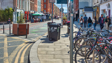
Cycling and walking
Catering for the increased volume of existing cyclists and seeking to provide adequate service to attract new cyclists, the strategy outlines plans to extend the cycle network to over 1,485km and provide 1,300kms of new connections between towns and rural areas. As well as primary and secondary routes, the strategy proposes several additional greenways.
While accommodating the Metropolitan Area, the Greater Dublin Area Cycle Network Plan, also sets out a cycle network for the main towns across the region, and connections for these towns, with each other and the Metropolitan area. It is proposed that many of the key cycling routes will be segregated from traffic via kerb separators and higher road levels.
Among plans for many enhancements of provisions for pedestrians, the main elements consist of collaboration with local authorities to develop a strategic pedestrian network plan. Outside of the Metropolitan areas things such as speed limits, accessibility and parking restrictions receive most of the focus, while within the busier areas, schemes such as footpath widening, road junction revision and reduced crossing waiting times are identified as priorities.
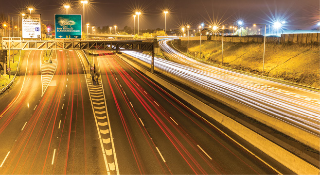
Road network
Plans to improve the national, regional and local road network for the Greater Dublin Area appear to be more governed by restrictions than potential expansion. Although several significant upgrades and improvements have been proposed, the principles of the plan reflect the national transport policy which seeks to reduce growth in car travel and increase use of public transport, cycling and walking. For this reason, the strategy outlines that there will be no significant increase in road capacity for private vehicles on radial roads inside the M50 motorway. Most roads, other than motorways or express roads, will be designed with the outcome of providing for walking, cycling and public transport and the strategy is guided by the principle that alternative solutions, such as public transport provision or traffic management, are not appropriate to address the road proposal not following the national guidelines.
Further details on the strategy, including plans for freight, park and ride and parking supply can be found within the Transport Strategy for the Greater Dublin Area 2016-2035, which is available on the National Transport Authority website.